
📃 Dataset Overview
- Naturalistic trajectory dataset on three different recording locations
- In total ~ 13 740 road users
- All road users classes: car, van, trailer, truck, bus, pedestrians, bicyclists, motorcyclists
- Variety of roundabouts with different speed limits
⭐ High Quality and Variety
- High tracking and classification accuracy
- High positioning accuracy
- Highly naturalistic trajectories
- Excellent digital maps (lanelet2 and OpenDRIVE)
🛠️ Supplementary Data
- ASAM OpenDRIVE maps
- Lanelet2 maps
The rounD dataset was created and published by a team from the Institute for Automotive Engineering (ika) of RWTH Aachen University to promote research in many different domains of mobility. The dataset can therefore be downloaded and used free of charge for academic and research purposes.
Method
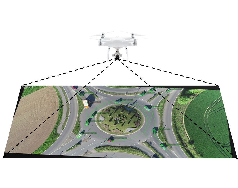
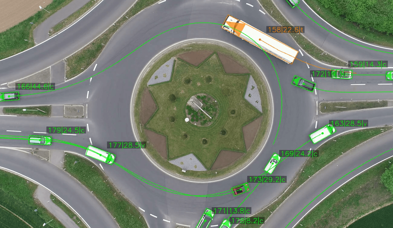
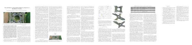
The rounD dataset introduces a fresh compilation of natural road user trajectory data from German roundabouts, gathered using drone technology to navigate past usual challenges such as occlusions inherent in traditional traffic data collection methods. It includes traffic data from three unique locations, capturing the movement and categorizing each road user by type. Advanced computer vision algorithms are applied to ensure high positional accuracy. This dataset is highly adaptable for a variety of applications, including predicting road user behavior, driver modeling, scenario-based safety evaluations for automated driving systems, and the data-driven creation of Highly Automated Driving (HAD) system components.
What’s included?
- Georeferenced trajectory data (e.g. position, heading, lat./long. velocity/acceleration)
- Recording Meta Information (e.g. frame rate, gps of location or # of objects)
- Track Meta Information (e.g. road user type, size and class)
- One digital map representation for each location in
- OpenDRIVE format including 3D information (fbx & osgb)
- Lanelet2 format
- One aerial photograph of each location without road users
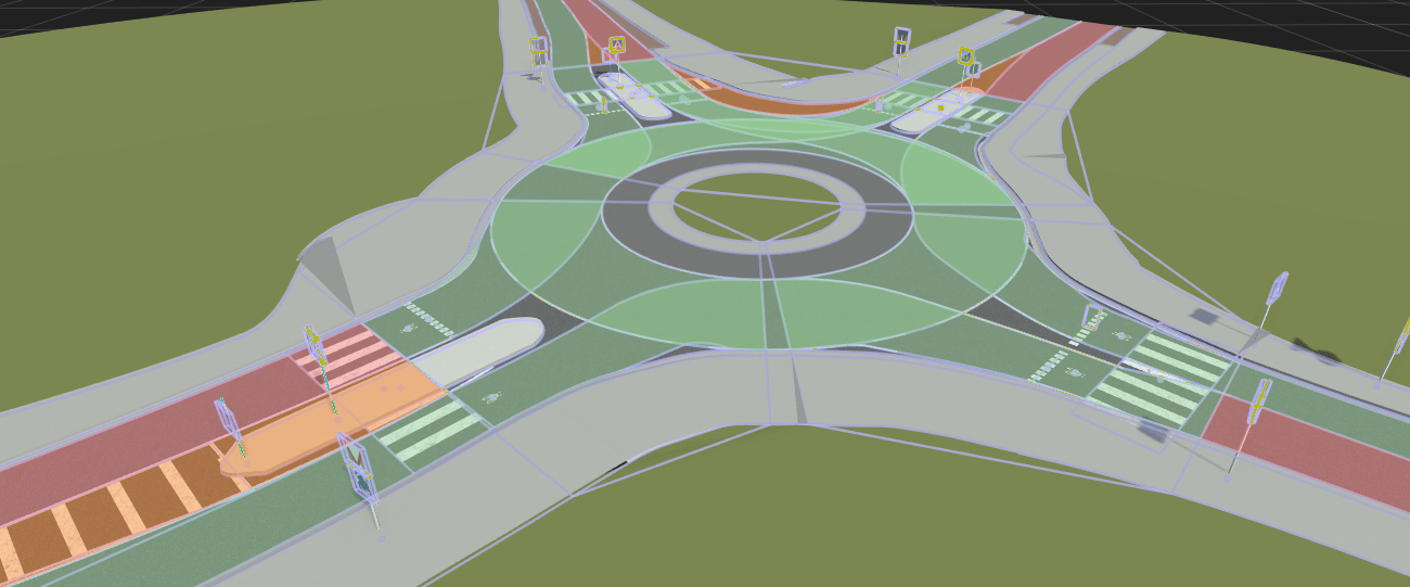
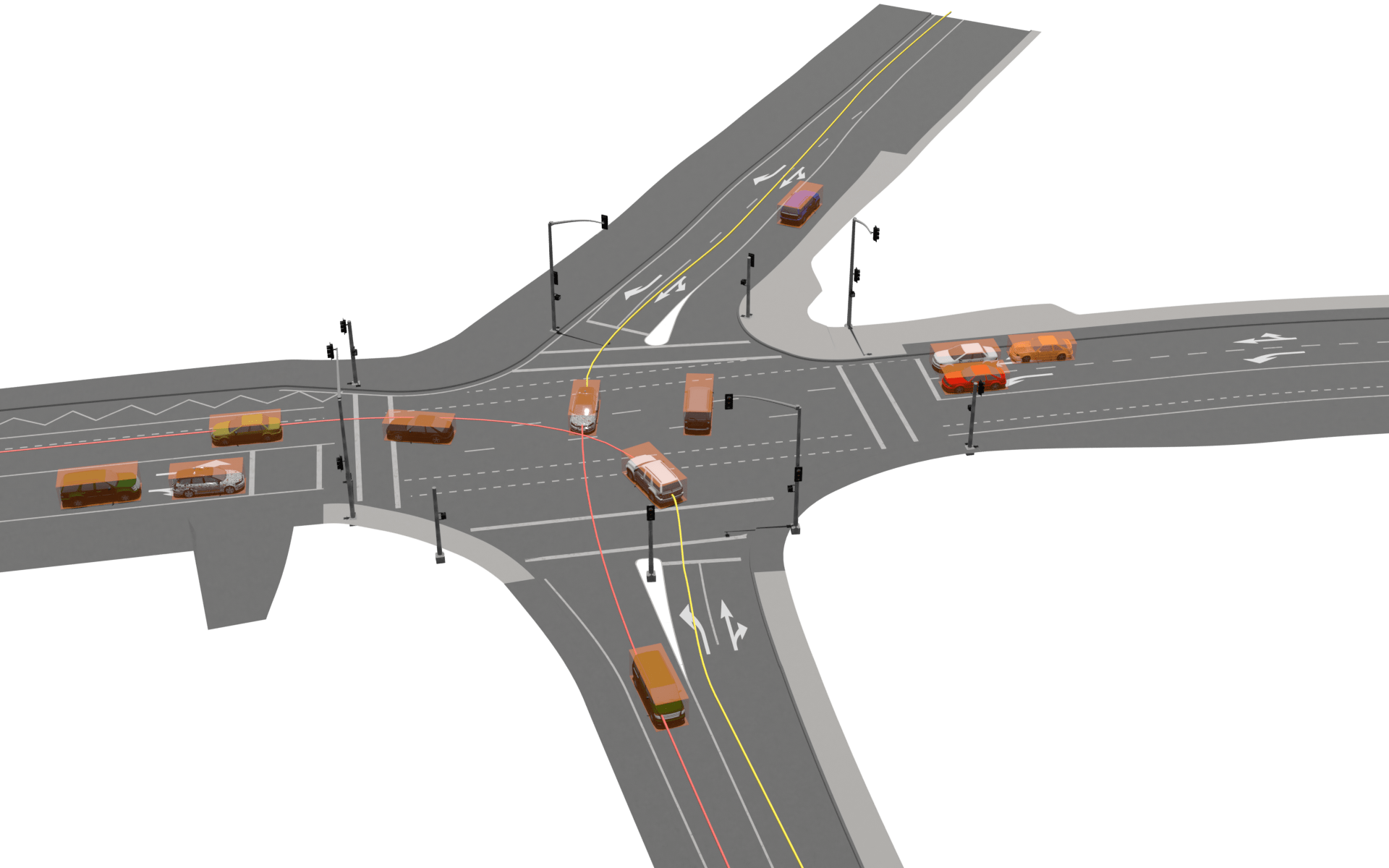
Digital Maps **NEW**
Our dataset includes detailed high-definition maps, enabling the analysis of trajectories in relation to the infrastructure. It supports both ASAM OpenDRIVE and Lanelet2 formats for comprehensive compatibility. Furthermore, these maps facilitate the seamless integration of our trajectory data into prominent simulation tools. To enhance this integration, we provide 3D environments corresponding to the maps in all major formats, including *.osgb and *.fbx, among others.
Applications
This dataset is incredibly versatile, serving a wide range of applications including road user prediction, driver behavior modeling, scenario-based safety validation for automated driving systems, and the development of components for Highly Automated Driving (HAD) systems. Its utility spans from enhancing the understanding of driving dynamics to supporting the refinement and innovation of autonomous vehicle technologies, thereby contributing significantly to advancements in the field of automated driving.
Citation
Our paper introducing the dataset and the used methods is published at the IEEE ITSC 2020 and available here. To reference the dataset, please use:
@inproceedings{rounDdataset,
    title={The rounD Dataset: A Drone Dataset of Road User Trajectories at Roundabouts in Germany},
    author={Krajewski, Robert and Moers, Tobias and Bock, Julian and Vater, Lennart and Eckstein, Lutz},
    booktitle={2020 IEEE 23rd International Conference on Intelligent Transportation Systems (ITSC)},
    pages={1-6},
    year={2020},
    doi={10.1109/ITSC45102.2020.9294728}
}
Application for Access for Non-Commercial Use
To apply for access to the dataset, please send us a request using this form. Please note that each request is checked manually. Therefore, make sure that that your answers are complete, detailed and correct. If any ambiguities arise, we may contact you for clarification purposes.
Commercial Use
The rounD dataset is free for non-commercial use only. If you are interested in commercial use, please visit https://levelxdata.com. Under levelXdata, fka GmbH combines its expertise in the field of data acquisition and processing for all stages of automated driving.

Full Usage Rights
Acquire the rights to use the dataset for commercial purposes and develop your own commercial applications and solutions.
Analysis
The leveLXData team can provide or support your analyses, evaluations and also parameterization of models on the basis of the data.
Individual Solutions
leveLXData can tailor a dataset for your requirement, either from an extensive database or based on new traffic recordings along your needs.
More Datasets
In addition to the rounD dataset, we used the same methodlogy to create more datasets. Specifically, the highD dataset covers trajectories of vehicles on German highways. The interactions of vehicles at entries and exits of German highways are captured in the exiD dataset.
The inD dataset contains trajectories of road users at roundabouts in Germany. Similarly the uniD dataset covers the behavior of road users at the RWTH Aachen University Campus. Find out more about these datasets on the individual websites.
Contact
Institute for Automotive Engineering, RWTH Aachen University
Vehicle Intelligence and Automated Driving
Steinbachstraße 7
52074 Aachen
Germany
leveLXData by fka GmbH
Steinbachstraße 7
52074 Aachen
Germany