hetroD 1.0 is now available!
Please apply below. We will keep you posted about updates.
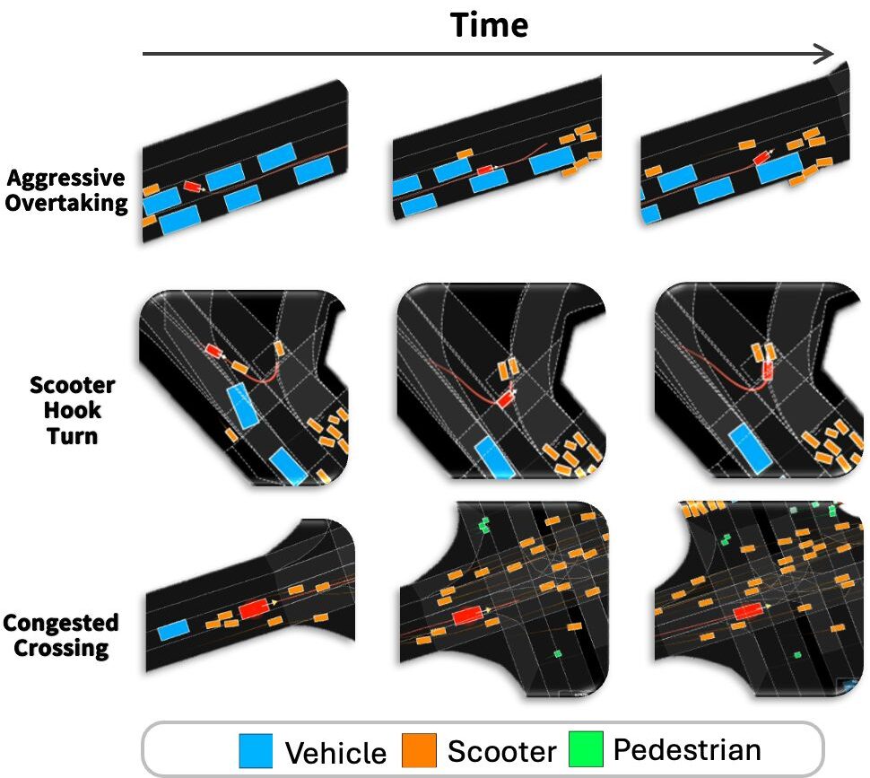
hetroD brings 17.5 hours of high-density, complex Taiwanese urban traffic to your research. Traffic flow doesn’t follow Western patterns. Scooters outnumber cars. VRUs and vehicles share space by instinct, not by strict rules.
Currently, the downloadable dataset contains all data in a preliminary quality stage, which is suitable for most analysis use cases. We will update the data to the final high quality in the next weeks. We will keep you informed about updates by email, if you check the mark at the application form.
For reference, the dataset contains three sample in high quality.
Check the paper for some detailed insights and analyses!
📃 Dataset Overview
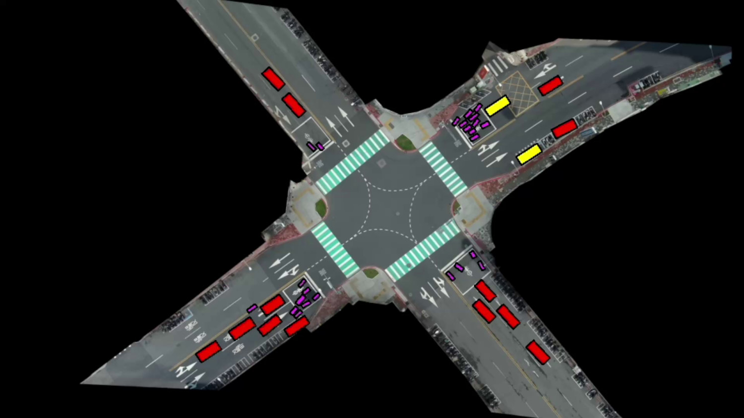
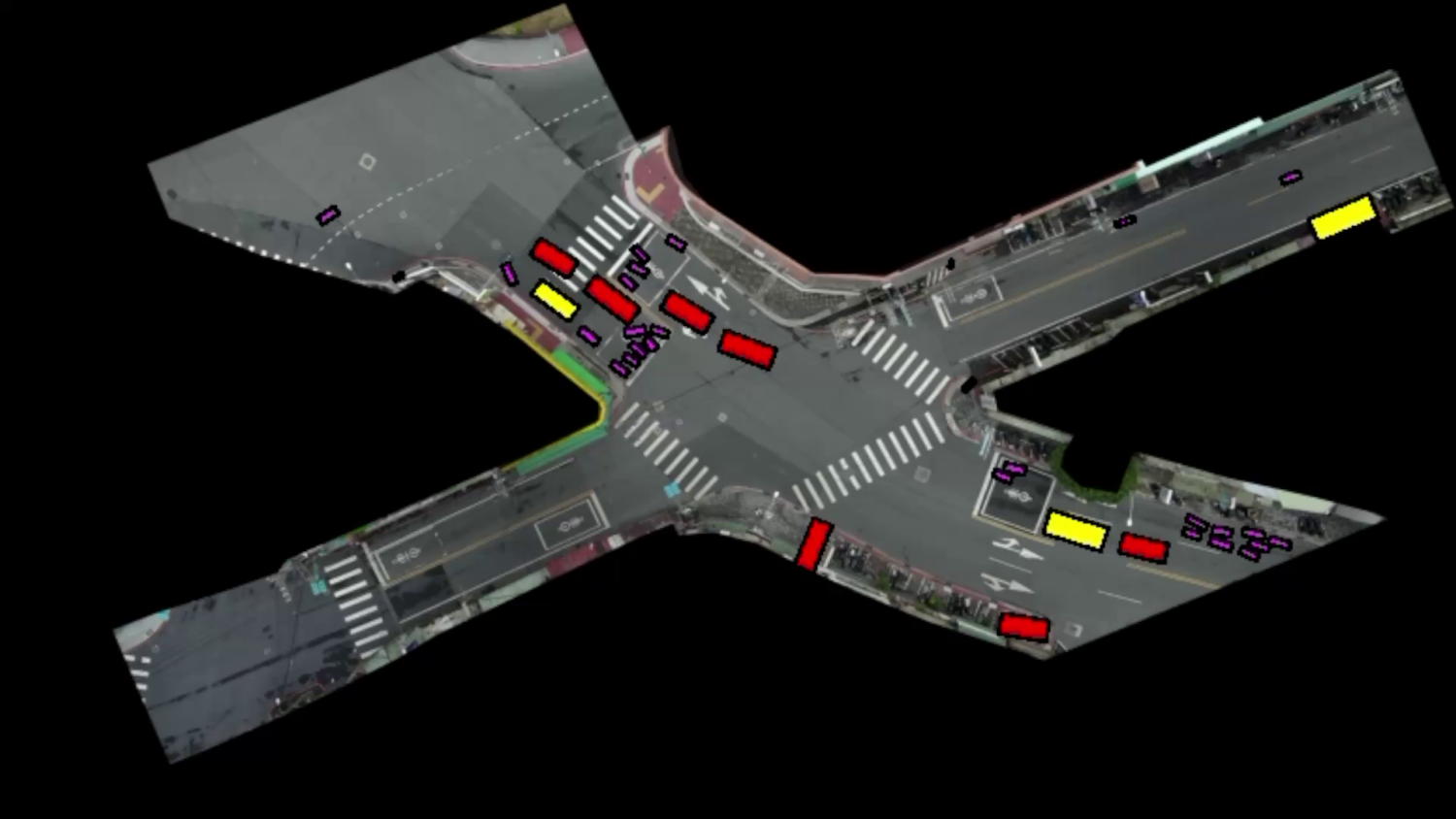
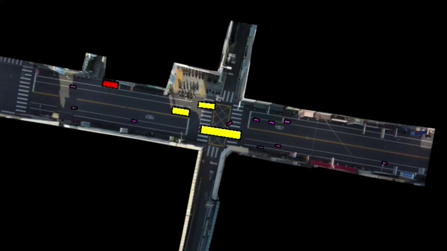
- Naturalistic trajectory dataset on six different recording locations
- In total more than 65.000 trajectories
- Nearly 70% VRUs (pedestrian, bicycle, motorcycle)
- All road users classes: car, truck, bus, pedestrian, bicyclist, motorcycle, trailer
- Highly interactive and heterogenous traffic flow
⭐ High Quality and Variety
- High tracking and classification accuracy
- High positioning accuracy
- Highly naturalistic trajectories
- Excellent digital maps (lanelet2 and OpenDRIVE)
🚀 Easy Start
- Find quick start scripts here:
- Parsing of provided files
- Visualization of recorded trajectories
- Tooling for ego vehicle based analyses is available here:
- Ego-centric scenario alignment
- Conversion to ScenarioNet, VBD, Scenario Dreamer
A specific format description will be available soon! For reference, check the inD dataset description here.
The hetroD dataset was created and published by a team of researchers from
- HCIS Lab, National Yang Ming Chiao Tung University, Taiwan,
- Mechanical Systems Control Lab, UC Berkeley, USA,
- leveLXData by fka GmbH, Germany.
The goal is to provide a dataset and benchmark for developing autonomous driving systems in heterogeneous environments and at the same time to help promote research in many other different domains of mobility. The dataset can therefore be downloaded and used free of charge for academic and research purposes.
Special thanks to our partners at C-Link Technology Inc. for providing the drones and helping to record the data.
https://www.c-link.com.tw/

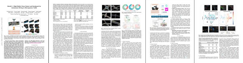
Method
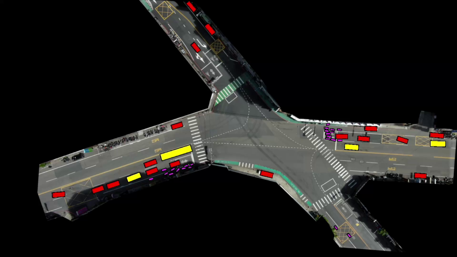
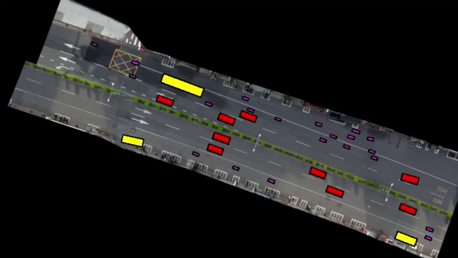
The dataset is a collection of vehicle trajectory data from Taiwanese intersections, captured via drone to bypass common issues like occlusions seen in traditional traffic data collection. It encompasses traffic recordings from six distinct locations, detailing each road user’s movement and type. Leveraging advanced computer vision algorithms, the dataset achieves high positional accuracy. Its versatility makes it ideal for applications such as predicting road user behavior, driver modeling, scenario-based safety assessments for automated driving systems, and data-driven development of Highly Automated Driving (HAD) system components.
What’s included?
- Georeferenced trajectory data (e.g. position, heading, lat./long. velocity/acceleration)
- Recording Meta Information (e.g. frame rate, gps of location or # of objects)
- Track Meta Information (e.g. road user type, size and class)
- One digital map representation for each location in
- OpenDRIVE format including 3D information (fbx & osgb)
- Lanelet2 format
- One aerial photograph of each location without road users
Citation
The paper introducing the dataset and the used methods will be published at the IEEE ICRA 2026. It is available here.
To reference the dataset, please use:
@inproceedings{hetrod,
title={HetroD: A High-Fidelity Drone Dataset and Benchmark for Autonomous Driving in Heterogeneous Traffic},
author={Yu-Hsiang Chen and Wei-Jer Chang and Christian Kotulla and Thomas Keutgens and Steffen Runde and Tobias Moers and Christoph Klas and Wei Zhan and Masayoshi Tomizuka and Yi-Ting Chen},
booktitle={Proceedings of the IEEE International Conference on Robotics and Automation (ICRA) },
year={2026}
}
Application for Access for Non-Commercial Use
To apply for access to the dataset sample, please send us a request using this form. Please note that each request is checked manually. Therefore, make sure that that your answers are complete, detailed and correct. If any ambiguities arise, we may contact you for clarification purposes.
Commercial Use
The hetroD dataset is free for non-commercial use only. If you are interested in commercial use, please visit https://levelxdata.com. With leveLXData, fka GmbH combines its expertise in the field of data acquisition and processing for all stages of automated driving.
Full Usage Rights
Acquire the rights to use the dataset for commercial purposes and develop your own commercial applications and solutions.
Analysis
The leveLXData team can provide or support your analyses, evaluations and also parameterization of models on the basis of the data.
Individual Solutions
leveLXData can tailor a dataset for your requirement, either from an extensive database or based on new traffic recordings along your needs.
More Datasets
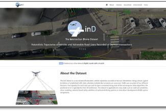
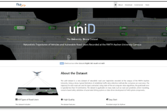
In addition to hetroD, we used the same methodlogy to create more public datasets. Specifically, the highD dataset covers trajectories of vehicles on German highways. The interactions of vehicles at entries and exits of German highways are captured in the exiD dataset. The highly interactive behavior of road users at urban intersections is captured in the inD dataset. The rounD dataset contains trajectories of road users at roundabouts in Germany. Similarly the uniD dataset covers the behavior of road users at the RWTH Aachen University Campus. Find out more about these datasets on the individual websites.

Contact
Yu-Hsiang Chen
Human-centered Intelligent System Lab (HCIS Lab)
National Yang Ming Chiao Tung University, Taiwan
Director: Yi-Ting Chen, Associate Professor
leveLXData by fka GmbH
Steinbachstraße 7
52074 Aachen
Germany